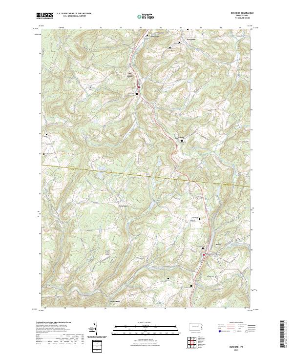
2023 Map of Dushore
USGS Topo · Published 2023About this map
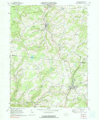
Dushore sits at the junction of modern transit corridors in this upland area of Sullivan County, where narrow valleys and elevated plateaus dictate the pattern of settlement. The landscape is defined by the headwaters of several drainages, including the South Branch Towanda Creek which flows through Laddsburg and New Albany, and Little Loyalsock Creek to the south near Cherry Mills. Local family history is preserved in numerous upland burial sites, such as the Heverly Family Cem and Wilcox Stevenson Cem, often situated near prominent terrain features like Hatch Hill.
Find a feature on this map
68 named features on this map. Tap any name to fly to it.
Don’t see what you’re looking for? This feature index may not catch every label — zoom into the map to look around manually.
Map Details
Editions of this 2023 Dushore Map
This is the sole edition of this map. No revisions or reprints were ever made.