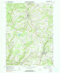
1969 Map of Dushore
USGS Topo · Published 1991About this map
Dushore serves as the primary hub in this late 1960s study, situated at the confluence of Marsh Run, Little Loyalsock Creek, and Mill Creek. The town is a center of local life, featuring St Basil's Sch, St Pauls Ch, and the Redeemer Ch, with a Drive-in Theater located just to the north. This area of Sullivan and Bradford Counties is defined by the winding course of the Lehigh Valley railroad and South Branch Towanda Creek, which together dictate the placement of smaller settlements like New Albany, Ladds, and Laddsburg. The landscape transition from agricultural valley bottoms to the more remote State Game Lands No 36 in the northwest is marked by numerous family-named landmarks and rural institutions, including Mt Tabor Ch and Coyles Corners.
Find a feature on this map
42 named features on this map. Tap any name to fly to it.
Don’t see what you’re looking for? This feature index may not catch every label — zoom into the map to look around manually.
Map Details
Editions of this 1969 Dushore Map
3 editions found
Other maps of this area

1927 · Eagles Mere
USGS Topo · 1:48,000

1932 · Eagle Mere
USGS Topo · 1:62,500

1934 · Laporte
USGS Topo · 1:62,500

1943 · Monroeton
USGS Topo · 1:62,500

1943 · Powell
USGS Topo · 1:62,500

1945 · Powell
USGS Topo · 1:62,500

1953 · LaPorte
USGS Topo · 1:62,500

1953 · Eagles Mere
USGS Topo · 1:62,500

1954 · Williamsport
USGS Topo · 1:250,000

1960 · Williamsport
USGS Topo · 1:250,000