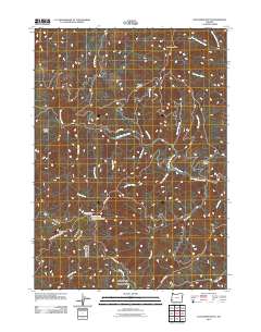
2011 Map of Dutchman Butte
USGS Topo · Published 2011About this map
Ninemile Mountain and the high ridges of Douglas County define this landscape, where the drainage systems of the West Fork Cow Creek and Bear Creek carve through the terrain. This 2011 survey documents a remote region of Oregon dominated by timber management and fire lookout infrastructure, notably at Calvert Peak with its associated Calvert Peak Airstrip. The map records a network of Bureau of Land Management routes, including West Fork Rd and the Mule Creek-Marial Rd, which provide access to high-elevation points like Dutchman Butte and Hayes Ridge. Small, isolated landmarks such as Ninemile Camp and Ninemile Spring suggest the area's continued use for forestry and recreational transit. The nomenclature often reflects local character or physical conditions, seen in features like No Sweat Creek, Slotted Pen Creek, and Jackass Prairie.
Find a feature on this map
30 named features on this map. Tap any name to fly to it.
Don’t see what you’re looking for? This feature index may not catch every label — zoom into the map to look around manually.
Map Details
Editions of this 2011 Dutchman Butte Map
This is the sole edition of this map. No revisions or reprints were ever made.
Other maps of this area

1946 · Galice
USGS Topo · 1:62,500

1946 · Dutchman Butte
USGS Topo · 1:62,500

1948 · Galice
USGS Topo · 1:62,500

1948 · Dutchman Butte
USGS Topo · 1:62,500

1954 · Bone Mountain
USGS Topo · 1:62,500

1954 · Marial
USGS Topo · 1:62,500

1955 · Medford
USGS Topo · 1:250,000

1957 · Medford
USGS Topo · 1:250,000

1958 · Medford
USGS Topo · 1:250,000
1989 · Kelsey Peak
USGS Topo · 1:24,000