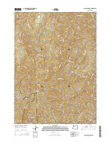
2014 Map of Dutchman Butte
USGS Topo · Published 2014About this map
Dutchman Butte rises above a landscape defined by the intersection of Douglas, Curry, and Josephine counties in southern Oregon. This 2014 survey captures a terrain marked by extensive Bureau of Land Management road networks, such as BLM-32-8-1.1 and BLM-4608, which weave through the drainage basins of West Fork Cow Creek and Mule Cr. The prominence of Ninemile Mtn and Hayes Ridge suggests a region primarily dedicated to timber and resource management, with higher elevations such as Walker Prairie and Jackass Prairie breaking the timberline. A unique aviation landmark, the Calvert Peak Airport, sits perched on a ridgeline, providing a critical access point in this remote corner of the Pacific Northwest. Smaller water features like Ninemile Spring and Slotted-Pen Cr underscore the complex hydrology that feeds into the larger W Fork Cow Cr system.
Find a feature on this map
42 named features on this map. Tap any name to fly to it.
Don’t see what you’re looking for? This feature index may not catch every label — zoom into the map to look around manually.
Map Details
Editions of this 2014 Dutchman Butte Map
This is the sole edition of this map. No revisions or reprints were ever made.
Other maps of this area

1946 · Galice
USGS Topo · 1:62,500

1946 · Dutchman Butte
USGS Topo · 1:62,500

1948 · Galice
USGS Topo · 1:62,500

1948 · Dutchman Butte
USGS Topo · 1:62,500

1954 · Bone Mountain
USGS Topo · 1:62,500

1954 · Marial
USGS Topo · 1:62,500

1955 · Medford
USGS Topo · 1:250,000

1957 · Medford
USGS Topo · 1:250,000

1958 · Medford
USGS Topo · 1:250,000
1989 · Kelsey Peak
USGS Topo · 1:24,000