2023 Map of Earlville
USGS Topo · Published 2023About this map
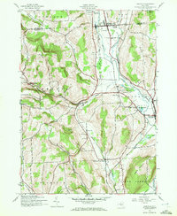
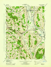
Earlville and Smyrna anchor this Chenango County landscape where the Chenango River and Sangerfield River meet amidst a backdrop of high ridges and deep hollows. The terrain is marked by significant topographical landmarks such as Steam Sawmill Hill, Negro Hill, and Tinker Ridge, which overlook a network of tributary streams including Cold Spring Brook and Fly Creek. The map provides a clear picture of the region's agricultural and rural structure, defined by family-named roadways like Lawrence Hunsicker Rd and Hopkins Crandall Rd.
Find a feature on this map
92 named features on this map. Tap any name to fly to it.
Don’t see what you’re looking for? This feature index may not catch every label — zoom into the map to look around manually.
Map Details
Editions of this 2023 Earlville Map
This is the sole edition of this map. No revisions or reprints were ever made.
Historical Maps of Earlville Through Time
3 maps found