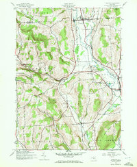
1943 Map of Earlville
USGS Topo · Published 1972About this map
The Sangerfield River valley serves as a primary corridor for settlement and transit in this mid-century portrait of Chenango and Madison counties. Centered on Earlville and Smyrna, the landscape is defined by the competition between the New York Ontario and Western and the Delaware Lackawanna and Western railroads. These lines track the watercourses, linking smaller hamlets like Upperville and Sherburne Four Corners to the regional economy.
Find a feature on this map
39 named features on this map. Tap any name to fly to it.
Don’t see what you’re looking for? This feature index may not catch every label — zoom into the map to look around manually.
Map Details
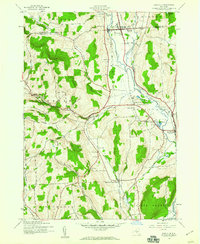
Editions of this 1943 Earlville Map
2 editions found
Other maps of this area

1902 · Morrisville
USGS Topo · 1:62,500

1903 · Norwich
USGS Topo · 1:62,500

1907 · Sangerfield
USGS Topo · 1:62,500

1910 · New Berlin
USGS Topo · 1:62,500

1912 · New Berlin
USGS Topo · 1:62,500

1943 · Otselic
USGS Topo · 1:24,000

1943 · West Eaton
USGS Topo · 1:24,000

1943 · Hubbardsville
USGS Topo · 1:24,000

1943 · Sangerfield
USGS Topo · 1:62,500

1943 · Holmesville
USGS Topo · 1:24,000