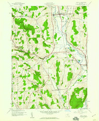
1943 Map of Earlville
USGS Topo · Published 1960About this map
The New York Ontario and Western RR and Delaware Lackawanna and Western RR dominate the valley floor of the Chenango River in this 1943 survey, illustrating the critical transportation corridor between Earlville and Sherburne. A notable relic of an earlier era is the Chenango Canal (Abandoned), which traces the same low-lying path as the modern rails and the Sangerfield River. The surrounding hills, such as Negro Hill and Church Hill, are dotted with isolated rural identifiers including School No 5 and several family-named burial grounds like Wilcox Cem and Reynolds Cem. The southern extent features the rural junction at Sherburne Four Corners, while the Rogers State Game Farm occupies the fertile lands near the river confluence, highlighting the 1940s land use patterns in Chenango County.
Find a feature on this map
46 named features on this map. Tap any name to fly to it.
Don’t see what you’re looking for? This feature index may not catch every label — zoom into the map to look around manually.
Map Details
Editions of this 1943 Earlville Map
2 editions found
Other maps of this area

1902 · Morrisville
USGS Topo · 1:62,500

1903 · Norwich
USGS Topo · 1:62,500

1907 · Sangerfield
USGS Topo · 1:62,500

1910 · New Berlin
USGS Topo · 1:62,500

1912 · New Berlin
USGS Topo · 1:62,500

1943 · Otselic
USGS Topo · 1:24,000

1943 · West Eaton
USGS Topo · 1:24,000

1943 · Hubbardsville
USGS Topo · 1:24,000

1943 · Sangerfield
USGS Topo · 1:62,500

1943 · Holmesville
USGS Topo · 1:24,000