
1943 Map of Hubbardsville
USGS Topo · Published 1960About this map
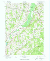
Ninemile Swamp dominates the central valley of this Madison County landscape, where the Sangerfield River winds through a dense wetland corridor. In the early 1940s, the Delaware Lackawanna and Western railroad provided the primary industrial backbone for the region, connecting the village of Hubbardsville to outlying hamlets like North Brookfield and East Hamilton. The terrain is defined by a series of named highlands, including Bacon Hill, Turkey Hill, and Crumb Hill, which separated tight-knit rural communities. Genealogists can identify numerous family-named crossroads such as Sixby Corners, Durfee Corners, and Brooks Corners. Local civic life is anchored by several rural schoolhouses, including School No 8 and the Beaver Meadow Sch, alongside quiet burial grounds like Tarrytown Cem and Faulkner Cem. This era shows the traditional agricultural and rail-oriented settlement pattern before modern highway expansions altered the rural character of central New York.
Find a feature on this map
54 named features on this map. Tap any name to fly to it.
Don’t see what you’re looking for? This feature index may not catch every label — zoom into the map to look around manually.
Map Details
Editions of this 1943 Hubbardsville Map
2 editions found
Other maps of this area

1902 · Morrisville
USGS Topo · 1:62,500

1903 · Norwich
USGS Topo · 1:62,500

1907 · Sangerfield
USGS Topo · 1:62,500

1910 · New Berlin
USGS Topo · 1:62,500

1912 · New Berlin
USGS Topo · 1:62,500

1943 · New Berlin North
USGS Topo · 1:24,000

1943 · Cassville
USGS Topo · 1:24,000

1943 · Sangerfield
USGS Topo · 1:62,500
1943 · Brookfield
USGS Topo · 1:24,000
1943 · Sherburne
USGS Topo · 1:24,000