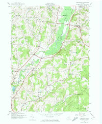
1943 Map of Hubbardsville
USGS Topo · Published 1974About this map
Ninemile Swamp dominates the central valley of this 1943 survey, a prominent natural feature where the Sangerfield River winds through the borderlands of Oneida and Madison counties. The economic life of the region is defined by the Delaware Lackawanna and Western railroad, which threads through Hubbardsville and North Brookfield, linking these small dairy-country hubs. The landscape is dotted with numerous "corners" and named crossroads—such as Sixby Corners, Loomis Corners, and Excell Corners—revealing a settlement pattern of tight-knit agricultural clusters during the early 1940s. Genealogists can find localized landmarks including Cole Hill Sch, Black Sch, and the Faulkner Cem. This era shows the rural infrastructure of central New York just before the post-war shift toward larger consolidated districts and modern highways.
Find a feature on this map
53 named features on this map. Tap any name to fly to it.
Don’t see what you’re looking for? This feature index may not catch every label — zoom into the map to look around manually.
Map Details
Editions of this 1943 Hubbardsville Map
2 editions found
Other maps of this area

1902 · Morrisville
USGS Topo · 1:62,500

1903 · Norwich
USGS Topo · 1:62,500

1907 · Sangerfield
USGS Topo · 1:62,500

1910 · New Berlin
USGS Topo · 1:62,500

1912 · New Berlin
USGS Topo · 1:62,500

1943 · New Berlin North
USGS Topo · 1:24,000

1943 · Hubbardsville
USGS Topo · 1:24,000

1943 · Cassville
USGS Topo · 1:24,000

1943 · Sangerfield
USGS Topo · 1:62,500
1943 · Brookfield
USGS Topo · 1:24,000