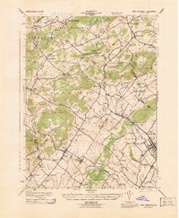
1943 Map of East Greenville
USGS Topo · Published 1943About this map
The crossroads of Berks, Lehigh, and Montgomery Counties are defined by a complex network of creeks and small settlements during the mid-war era. Perkiomen Creek and its tributaries, including Hosensack Creek and Swamp Creek, carve through a landscape of prominent elevations like Furnace Hill and Blackhead Hill. The density of small villages—from the larger centers of East Greenville and Pennsburg to smaller outposts like Seisholtzville, Old Zionsville, and Huffs Church—reflects a well-established rural economy connected by the Reading railroad line.
Find a feature on this map
49 named features on this map. Tap any name to fly to it.
Don’t see what you’re looking for? This feature index may not catch every label — zoom into the map to look around manually.
Map Details
Editions of this 1943 East Greenville Map
This is the sole edition of this map. No revisions or reprints were ever made.
Other maps of this area

1888 · Quakertown
USGS Topo · 1:62,500

1890 · Quakertown
USGS Topo · 1:62,500

1894 · Allentown
USGS Topo · 1:62,500

1894 · Quakertown
USGS Topo · 1:62,500

1902 · Boyertown
USGS Topo · 1:62,500

1902 · Slatington
USGS Topo · 1:62,500

1937 · Allentown West
USGS Topo · 1:48,000

1939 · Allentown
USGS Topo · 1:62,500

1942 · Norristown
USGS Topo · 1:125,000

1942 · Allentown West
USGS Topo · 1:62,500