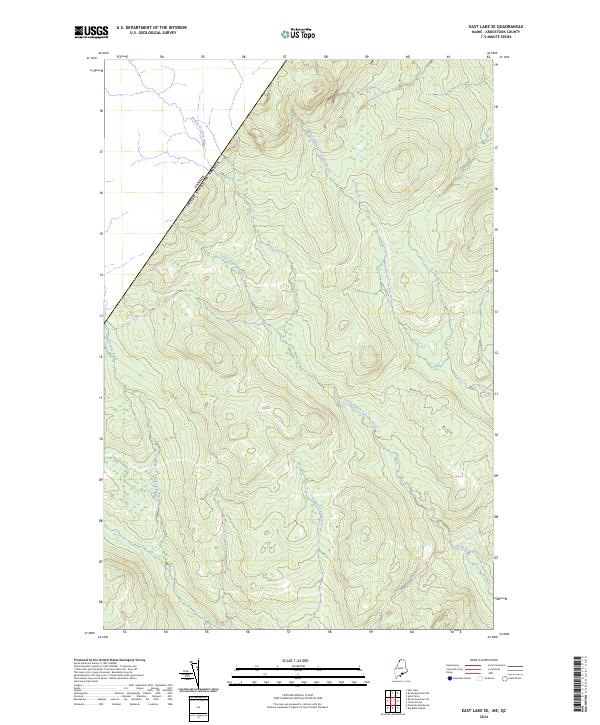
2024 Map of East Lake SE
USGS Topo · Published 2024About this map
The international boundary between Canada and the United States defines the northwestern edge of this Aroostook County landscape. This is a region of dense drainage networks and high-elevation terrain, where the headwaters of several major brooks originate and flow toward the Saint John River watershed. The northern portion is characterized by the Rivière des Deux Milles and the parallel courses of North Branch Twomile Brook and South Branch Twomile Brook.
Find a feature on this map
8 named features on this map. Tap any name to fly to it.
Don’t see what you’re looking for? This feature index may not catch every label — zoom into the map to look around manually.
Map Details
Editions of this 2024 East Lake SE Map
This is the sole edition of this map. No revisions or reprints were ever made.
Other maps of this area

1954 · Presque Isle
USGS Topo · 1:250,000

1955 · Rocky Mountain
USGS Topo · 1:62,500

1955 · Little East Lake
USGS Topo · 1:62,500

1955 · Round Pond
USGS Topo · 1:62,500

1955 · Seven Islands
USGS Topo · 1:62,500

1958 · Presque Isle
USGS Topo · 1:250,000

1960 · Presque Isle
USGS Topo · 1:250,000

1962 · Edmundston
USGS Topo · 1:250,000

1976 · East Lake
USGS Topo · 1:24,000

1976 · East Lake SE
USGS Topo · 1:24,000