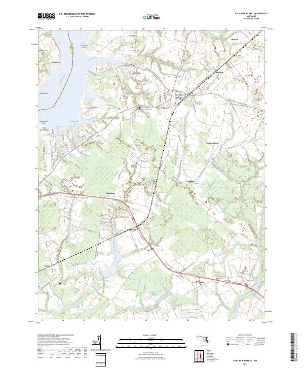
2023 Map of East New Market
USGS Topo · Published 2023About this map
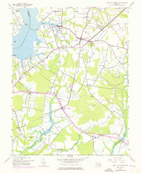
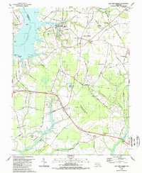
East New Market and Secretary serve as the primary hubs in this part of Dorchester County, where the landscape is defined by the winding tributaries of the Choptank River. The Warwick River and Indian Creek carve into the western shoreline, creating prominent features like Bolingbroke Neck and Secretarys Point. This modern survey illustrates the persistent agricultural and maritime character of the Maryland Eastern Shore, with small inland settlements like Thompsontown, Hawkeye, and Hicksburg connected by a web of local roads and the Maryland and Delaware RR. One of the most distinctive historical markers on the sheet is the Indian Grant near Indian Creek, a reminder of earlier land divisions in the region. Further south, the Transquaking River and Chicamacomico River drain toward the Chesapeake, passing by small community centers and burial grounds including Airey Cem and Mount Pleasant Cem.
Find a feature on this map
88 named features on this map. Tap any name to fly to it.
Don’t see what you’re looking for? This feature index may not catch every label — zoom into the map to look around manually.
Map Details
Editions of this 2023 East New Market Map
This is the sole edition of this map. No revisions or reprints were ever made.
Historical Maps of Salem Through Time
3 maps found