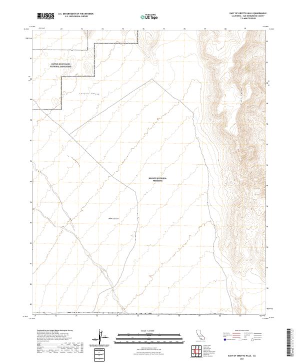
2021 Map of East of Grotto Hills
USGS Topo · Published 2021About this map
The Piute Range defines the eastern boundary of this high-desert landscape, where steep contours transition into the broad expanse of Lanfair Valley. This 2021 survey illustrates a region largely dedicated to federal conservation, dominated by the Mojave National Preserve and the Castle Mountains National Monument to the northwest. These designations reflect a modern era of land management focused on preserving the arid ecology of the Mojave Desert. The map reveals a sparse network of desert tracks and section lines, typical of a landscape where the primary human footprint is found in the maintenance of wilderness boundaries rather than permanent settlement. Researchers will find the township and range grids, such as t14n r17e, essential for pinpointing specific grazing or mining claims that historically dotted these valleys.
Find a feature on this map
11 named features on this map. Tap any name to fly to it.
Don’t see what you’re looking for? This feature index may not catch every label — zoom into the map to look around manually.
Map Details
Editions of this 2021 East of Grotto Hills Map
This is the sole edition of this map. No revisions or reprints were ever made.
Other maps of this area

1886 · Camp Mohave
USGS Topo · 1:250,000

1892 · Camp Mohave
USGS Topo · 1:250,000

1910 · Ivanpah
USGS Topo · 1:250,000

1912 · Ivanpah
USGS Topo · 1:250,000

1926 · Mohave City
USGS Topo · 1:96,000

1942 · Camp Mohave
USGS Topo · 1:250,000

1942 · Ivanpah
USGS Topo · 1:250,000

1947 · Kingman
USGS Topo · 1:250,000

1948 · Kingman
USGS Topo · 1:250,000

1954 · Kingman
USGS Topo · 1:250,000