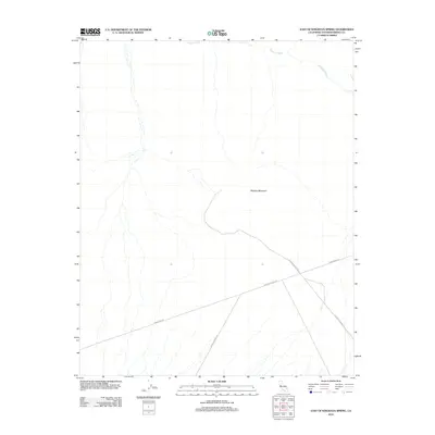
2012 Map of East of Kingston Spring
USGS Topo · Published 2012About this map
Shadow Mountain dominates this desert landscape in San Bernardino County, an area defined by the shifting course of Kingston Wash. In this 2012 depiction, the terrain is primarily marked by long-distance infrastructure rather than settlements, with prominent utility routes like Powerline Rd cutting across the arid basins. These roads, including Francis Springs Rd and Shadow Mountain Rd, provide the primary access through this corner of the California desert, connecting remote springs and mountain slopes. The map reveals the intricate network of ephemeral watercourses feeding into the main wash, illustrating the complex drainage patterns of this high-desert environment before it transitions into neighboring mountain ranges.
Find a feature on this map
5 named features on this map. Tap any name to fly to it.
Don’t see what you’re looking for? This feature index may not catch every label — zoom into the map to look around manually.
Map Details
Editions of this 2012 East of Kingston Spring Map
This is the sole edition of this map. No revisions or reprints were ever made.
Other maps of this area

1910 · Ivanpah
USGS Topo · 1:250,000

1912 · Ivanpah
USGS Topo · 1:250,000

1942 · Ivanpah
USGS Topo · 1:250,000

1947 · Kingman
USGS Topo · 1:250,000

1948 · Kingman
USGS Topo · 1:250,000

1954 · Kingman
USGS Topo · 1:250,000

1955 · Kingman
USGS Topo · 1:250,000
1955 · Kingston Peak
USGS Topo · 1:62,500
1955 · Mescal Range
USGS Topo · 1:62,500
1956 · Halloran Spring
USGS Topo · 1:62,500