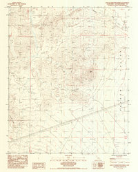
1984 Map of East of Kingston Spring
USGS Topo · Published 1985About this map
Shadow Mtn Mine sits at the heart of this desert landscape, surrounded by several identified Prospects that indicate the mining activity of the mid-1980s. The terrain is defined by the steep elevation of Shadow Mtn and the northern reaches of the Shadow Mountains, which overlook the broad expanse of Shadow Valley. Water drainage is primarily captured by Kingston Wash, a prominent feature running through the northern sector. Industrial development is evident through the path of 3 Steel Tower Transmission Lines cutting across the southern portion of the quadrangle. Several 4wd routes provide the only access through this arid region, connecting the scattered mining sites to the broader valley floor and outlining the remote character of this corner of San Bernardino County during this era.
Find a feature on this map
11 named features on this map. Tap any name to fly to it.
Don’t see what you’re looking for? This feature index may not catch every label — zoom into the map to look around manually.
Map Details
Editions of this 1984 East of Kingston Spring Map
This is the sole edition of this map. No revisions or reprints were ever made.
Other maps of this area

1910 · Ivanpah
USGS Topo · 1:250,000

1912 · Ivanpah
USGS Topo · 1:250,000

1942 · Ivanpah
USGS Topo · 1:250,000

1947 · Kingman
USGS Topo · 1:250,000

1948 · Kingman
USGS Topo · 1:250,000

1954 · Kingman
USGS Topo · 1:250,000

1955 · Kingman
USGS Topo · 1:250,000

1955 · Kingston Peak
USGS Topo · 1:62,500

1955 · Mescal Range
USGS Topo · 1:62,500

1956 · Halloran Spring
USGS Topo · 1:62,500