2024 Map of Eastabuchie
USGS Topo · Published 2024About this map
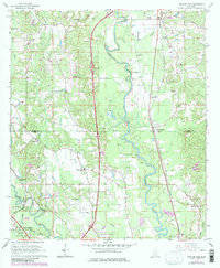
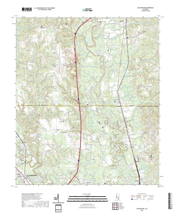
The Leaf River and Bowie River converge in this territory north of Hattiesburg, marking a landscape defined by its waterways and rural settlements. Crossing the boundary between Jones Co and Forrest Co, the map documents a transition from the industrial infrastructure of the Hattiesburg/Laurel Regional Airport to the older river crossings at Johnsons Ferry and Jenkins Ferry. These crossing points were vital nodes for early travel before the development of modern highway corridors that now bisect the region.
Find a feature on this map
130 named features on this map. Tap any name to fly to it.
Don’t see what you’re looking for? This feature index may not catch every label — zoom into the map to look around manually.
Map Details
Editions of this 2024 Eastabuchie Map
This is the sole edition of this map. No revisions or reprints were ever made.