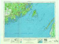
1969 Map of Eastport
USGS Topo · Published 1969About this map
Eastport and the surrounding islands of Passamaquoddy Bay anchor this 1969 revision of the Maine coast, illustrating a maritime landscape shaped by deep water and intricate shorelines. The map captures a period when the Maine Central Railroad and Canadian Pacific Railway still served the region's industrial and trade needs, connecting coastal settlements like Lubec and Machias to the interior. The international border is clearly defined between Maine and New Brunswick, cutting through the Grand Manan Channel and separating Campobello Island from the mainland. To the west, the interior reveals a network of lakes including Gardner Lake and Cathance Lake, while the protected lands of Moosehorn National Wildlife Refuge preserve the habitat near the St. Croix River. Across the water, the survey extends to the Nova Scotia Highway 101 corridor on Digby Neck, framing the vast Bay of Fundy.
Find a feature on this map
187 named features on this map. Tap any name to fly to it.
Don’t see what you’re looking for? This feature index may not catch every label — zoom into the map to look around manually.
Map Details
Editions of this 1969 Eastport Map
This is the sole edition of this map. No revisions or reprints were ever made.
Other maps of this area

1902 · Cherryfield
USGS Topo · 1:62,500

1904 · Cherryfield
USGS Topo · 1:62,500

1904 · Bar Harbor
USGS Topo · 1:62,500

1904 · Petit Manan
USGS Topo · 1:62,500

1907 · Eastport
USGS Topo · 1:48,000

1908 · Eastport
USGS Topo · 1:62,500

1917 · Cutler
USGS Topo · 1:62,500

1918 · Machias
USGS Topo · 1:62,500

1918 · Cutler
USGS Topo · 1:62,500

1921 · Great Wass Island
USGS Topo · 1:62,500