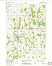
1981 Map of Edgar
USGS Topo · Published 1982About this map
The village of Edgar serves as the focal point of this Marathon County landscape, where the Chicago and North Western rail line and Scotch Creek intersect. This area reflects a deeply rooted agricultural and logging heritage, evident in the numerous family and church burial grounds like Tessmer Pioneer Cem and Holy Trinity Cem. Further north, the unincorporated community of Poniatowski sits near the headwaters of Pet Brook, while the town of Rib Falls occupies a bend in the Big Rib River.
Find a feature on this map
24 named features on this map. Tap any name to fly to it.
Don’t see what you’re looking for? This feature index may not catch every label — zoom into the map to look around manually.
Map Details
Editions of this 1981 Edgar Map
This is the sole edition of this map. No revisions or reprints were ever made.
Other maps of this area

1902 · Marathon
USGS Topo · 1:125,000

1951 · Athens
USGS Topo · 1:48,000

1951 · Hamburg
USGS Topo · 1:48,000

1953 · Marathon
USGS Topo · 1:48,000

1953 · Stratford
USGS Topo · 1:48,000

1953 · Eau Claire
USGS Topo · 1:250,000

1953 · Rice Lake
USGS Topo · 1:250,000

1954 · Iron Mountain
USGS Topo · 1:250,000

1955 · Green Bay
USGS Topo · 1:250,000

1958 · Eau Claire
USGS Topo · 1:250,000