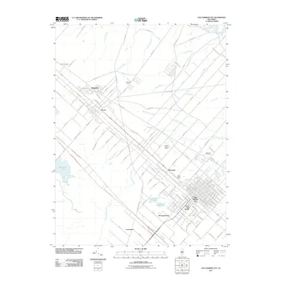
2011 Map of Egg Harbor City
USGS Topo · Published 2011About this map
Egg Harbor City anchors this portion of Atlantic County, appearing as a developed grid of streets punctuated by its southern extensions at South Egg Harbor and West Egg Harbor. The landscape is defined by the transition from structured town planning to the dense riparian networks of the Pine Barrens, with Landing Creek and Indian Cabin Creek threading through the territory. To the northwest, the settlement of Elwood and the smaller cluster at Magnolia sit along the primary rail and road corridors that have historically connected the region to the coast. Cultural and historical landmarks are scattered throughout the surrounding woods, including Laurel Hill Cemetery and the Amotol Race Track. The presence of Makepeace Lake and numerous small ponds like Big Goose Pond illustrates the area's characteristic hydrology, where low-lying basins and meandering branches like Watering Race Branch shape the rural development patterns of places like Carmantown.
Find a feature on this map
147 named features on this map. Tap any name to fly to it.
Don’t see what you’re looking for? This feature index may not catch every label — zoom into the map to look around manually.
Map Details
Editions of this 2011 Egg Harbor City Map
This is the sole edition of this map. No revisions or reprints were ever made.
Other maps of this area

1890 · Great Egg Harbor
USGS Topo · 1:62,500

1890 · Hammonton
USGS Topo · 1:62,500

1890 · Tuckahoe
USGS Topo · 1:62,500

1890 · Mullica
USGS Topo · 1:62,500

1893 · Great Egg Harbor
USGS Topo · 1:62,500

1893 · Tuckahoe
USGS Topo · 1:62,500

1894 · Hammonton
USGS Topo · 1:62,500

1894 · Mullica
USGS Topo · 1:62,500

1898 · Mullica
USGS Topo · 1:62,500

1898 · Hammonton
USGS Topo · 1:62,500
Featured Places
- Galloway Township, NJ
- Hamilton Township, NJ
- Mullica Township, NJ
- Egg Harbor City, NJ
- Washington Township, NJ