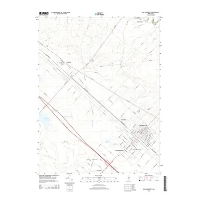
2014 Map of Egg Harbor City
USGS Topo · Published 2014About this map
Egg Harbor City and its surrounding satellite communities occupy this section of the New Jersey Pine Barrens, centered on the historic intersection of the White Horse Pike and the Atlantic City rail lines. The urban grid of the city stands in sharp contrast to the sprawling network of cedar swamps and tributaries like Indian Cabin Cr and Landing Cr that feed into the Mullica River system to the north. South of the city center, the landscape transitions into the smaller residential pockets of South Egg Harbor and West Egg Harbor, while the southern margin is defined by the high-speed corridor of the Atlantic City Expy.
Find a feature on this map
112 named features on this map. Tap any name to fly to it.
Don’t see what you’re looking for? This feature index may not catch every label — zoom into the map to look around manually.
Map Details
Editions of this 2014 Egg Harbor City Map
This is the sole edition of this map. No revisions or reprints were ever made.
Other maps of this area

1890 · Great Egg Harbor
USGS Topo · 1:62,500

1890 · Hammonton
USGS Topo · 1:62,500

1890 · Tuckahoe
USGS Topo · 1:62,500

1890 · Mullica
USGS Topo · 1:62,500

1893 · Great Egg Harbor
USGS Topo · 1:62,500

1893 · Tuckahoe
USGS Topo · 1:62,500

1894 · Hammonton
USGS Topo · 1:62,500

1894 · Mullica
USGS Topo · 1:62,500

1898 · Mullica
USGS Topo · 1:62,500

1898 · Hammonton
USGS Topo · 1:62,500
Featured Places
- Galloway Township, NJ
- Hamilton Township, NJ
- Mullica Township, NJ
- Egg Harbor City, NJ
- Washington Township, NJ