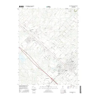
2016 Map of Egg Harbor City
USGS Topo · Published 2016About this map
Egg Harbor City and its surrounding communities are documented here within the unique Pine Barrens landscape of Atlantic County. This 2016 survey shows a grid of streets and avenues named for European thinkers and world locations, such as Goethe St, Darmstadt Ave, and Rhode Island Ave, reflecting the systematic early planning of this region. The map tracks the expansion of local settlements like Elwood, Devonshire, and South Egg Harbor, alongside the persistent natural hydrology of the area, including Makepeace Stream and Landing Cr. Genealogists will find the locations of Laurel Hill Cem and Egg Harbor Cem useful for family research. The landscape is defined by its transition from these organized residential hubs to the sprawling wetlands and intermittent ponds like Big Goose Pond and Little Goose Pond, illustrating the balance between mid-century development and the coastal plain's natural features.
Find a feature on this map
181 named features on this map. Tap any name to fly to it.
Don’t see what you’re looking for? This feature index may not catch every label — zoom into the map to look around manually.
Map Details
Editions of this 2016 Egg Harbor City Map
This is the sole edition of this map. No revisions or reprints were ever made.
Other maps of this area

1890 · Great Egg Harbor
USGS Topo · 1:62,500

1890 · Hammonton
USGS Topo · 1:62,500

1890 · Tuckahoe
USGS Topo · 1:62,500

1890 · Mullica
USGS Topo · 1:62,500

1893 · Great Egg Harbor
USGS Topo · 1:62,500

1893 · Tuckahoe
USGS Topo · 1:62,500

1894 · Hammonton
USGS Topo · 1:62,500

1894 · Mullica
USGS Topo · 1:62,500

1898 · Mullica
USGS Topo · 1:62,500

1898 · Hammonton
USGS Topo · 1:62,500
Featured Places
- Galloway Township, NJ
- Hamilton Township, NJ
- Mullica Township, NJ
- Egg Harbor City, NJ
- Washington Township, NJ