Loading...
Loading map...2023 Map of Elbe
USGS Topo · Published 2023About this map
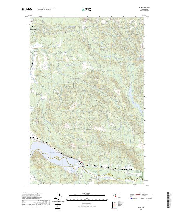
The Nisqually River and the sprawling waters of Alder Lake define the southern corridor of this Pierce County landscape. Centered on the settlement of Elbe, the map illustrates a region where timber production and mountain access meet, with the northwestern corner of Mount Rainier National Park appearing near Park Junction. To the north, the Mashel River and its tributaries, including the Little Mashel River and Beaver Creek, carve through the terrain surrounding Dobbs Mtn.
Find a feature on this map
50 named features on this map. Tap any name to fly to it.
Don’t see what you’re looking for? This feature index may not catch every label — zoom into the map to look around manually.
Map Details
Date Portrayed2023
Date Published2023
PublisherU.S. Geological Survey
Map TypeTopographic
Scale1:24000
Physical Dimensions24 x 29 inches
Editions of this 2023 Elbe Map
This is the sole edition of this map. No revisions or reprints were ever made.
Historical Maps of Elbe Through Time
Featured Locations
Source Details
SourceU.S. Geological Survey
CopyrightPublic Domain