Loading...
Loading map...2023 Map of Elderton
USGS Topo · Published 2023About this map
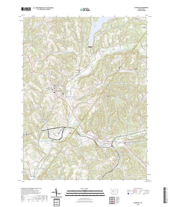
Elderton serves as the primary hub of this landscape, situated at a junction where several local roads converge near the Armstrong Co and Indiana Co line. The terrain is defined by the winding course of Crooked Creek and its many tributaries, including Plum Creek and Anthony Run. The construction of the dam creating Keystone Lake in the north and the smaller Shady Side Lake near Shelocta has significantly altered the drainage patterns of this rural region.
Find a feature on this map
97 named features on this map. Tap any name to fly to it.
Don’t see what you’re looking for? This feature index may not catch every label — zoom into the map to look around manually.
Map Details
Date Portrayed2023
Date Published2023
PublisherU.S. Geological Survey
Map TypeTopographic
Scale1:24000
Physical Dimensions24 x 29 inches
Editions of this 2023 Elderton Map
This is the sole edition of this map. No revisions or reprints were ever made.
Historical Maps of Advance Through Time
Featured Locations
Source Details
SourceU.S. Geological Survey
CopyrightPublic Domain