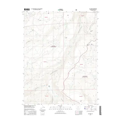
2016 Map of Elk Park
USGS Topo · Published 2016About this map
The Continental Divide winds through this high-elevation landscape in Saguache County, forming the boundary between the Gunnison National Forest and the Rio Grande National Forest. This 2016 survey documents a network of protected lands where the headwaters of several major drainages begin their descent, including Cochetopa Cr and the N Fork Saguache Cr. The map reveals a high-country terrain defined by open mountain meadows or "parks," such as Elk Park, Soro Park, and Burro Park.
Find a feature on this map
34 named features on this map. Tap any name to fly to it.
Don’t see what you’re looking for? This feature index may not catch every label — zoom into the map to look around manually.
Map Details
Editions of this 2016 Elk Park Map
This is the sole edition of this map. No revisions or reprints were ever made.
Other maps of this area
1914 · Creede
USGS Topo · 1:125,000
1916 · Creede
USGS Topo · 1:125,000

1945 · Durango
USGS Topo · 1:250,000

1953 · Durango
USGS Topo · 1:250,000
1954 · Durango
USGS Topo · 1:250,000

1956 · Montrose
USGS Topo · 1:250,000
1959 · Montrose
USGS Topo · 1:250,000
1959 · Creede
USGS Topo · 1:62,500
1960 · Montrose
USGS Topo · 1:250,000
1961 · Durango
USGS Topo · 1:250,000