2022 Map of Ella
USGS Topo · Published 2022About this map
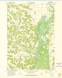
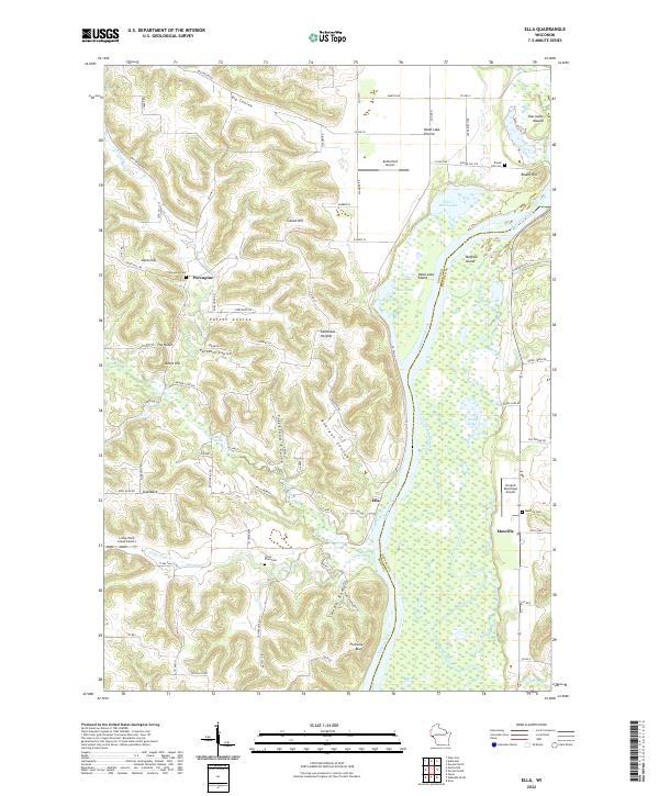
Ella sits along the Chippewa River in a landscape defined by the deep valleys and high bluffs of the Driftless Area. This terrain is marked by numerous coulees, such as Patten Coulee, Paradise Coulee, and Freckland Coulee, where small streams like Porcupine Cr and Little Plum Cr drain toward the river's floodplain. The river itself creates a complex system of waterways, including Buffalo Slough, Stump Lake, and Silver Birch Lake, separating the main channel from features like Buffalo Island. On the higher ground, small communities and rural centers such as Porcupine and Maxville are established near local landmarks like Gates Hill and Ganoe Hill. The map identifies several family and community burial sites, including Porcupine Cem and Maxville Cem, providing a detailed view of the rural settlement patterns that have persisted around Fivemile Bluff.
Find a feature on this map
79 named features on this map. Tap any name to fly to it.
Don’t see what you’re looking for? This feature index may not catch every label — zoom into the map to look around manually.
Map Details
Editions of this 2022 Ella Map
This is the sole edition of this map. No revisions or reprints were ever made.