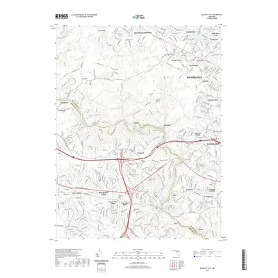
2019 Map of Ellicott City
USGS Topo · Published 2019About this map
The Patapsco River carves a deep path through this borderland of Baltimore and Howard Counties, serving as the central axis for a region defined by its industrial heritage and suburban expansion. The historic mill towns of Oella, Gray, and Thistle sit clustered along the river's lower reaches, while further upstream, the settlement of Daniels remains a point of interest near the Baltimore & Ohio RR tracks. The transition from the dense street grids of Milford Mill and Woodlawn in the east to the more dispersed landscapes of Woodstock and Granite in the west illustrates the diverse character of the Maryland Piedmont.
Find a feature on this map
67 named features on this map. Tap any name to fly to it.
Don’t see what you’re looking for? This feature index may not catch every label — zoom into the map to look around manually.
Map Details
Editions of this 2019 Ellicott City Map
This is the sole edition of this map. No revisions or reprints were ever made.
Other maps of this area

1892 · Laurel
USGS Topo · 1:62,500

1892 · Ellicott
USGS Topo · 1:62,500

1894 · Ellicott
USGS Topo · 1:62,500

1894 · Laurel
USGS Topo · 1:62,500

1894 · Baltimore
USGS Topo · 1:62,500

1894 · Relay
USGS Topo · 1:62,500

1897 · Laurel
USGS Topo · 1:62,500

1899 · Baltimore
USGS Topo · 1:62,500

1904 · Baltimore
USGS Topo · 1:62,500

1906 · Ellicott
USGS Topo · 1:62,500