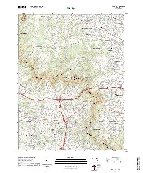
2023 Map of Ellicott City
USGS Topo · Published 2023About this map
The Patapsco River serves as a defining natural boundary in this contemporary survey, separating Ellicott City in Howard County from the burgeoning residential landscapes of Catonsville and Woodlawn in Baltimore County. The map details a dense network of suburban development intertwined with deep-rooted institutional history, notably the Woodstock College Jesuit Theological Sem and the Howard County Courthouse. The convergence of historical ecclesiastical sites, such as the Saint Pauls Methodist Episcopal Church Cem and Mount Gilboa A M E Church Cem, reveals the enduring community fabric of this corridor.
Find a feature on this map
76 named features on this map. Tap any name to fly to it.
Don’t see what you’re looking for? This feature index may not catch every label — zoom into the map to look around manually.
Map Details
Editions of this 2023 Ellicott City Map
This is the sole edition of this map. No revisions or reprints were ever made.
Other maps of this area

1892 · Laurel
USGS Topo · 1:62,500

1892 · Ellicott
USGS Topo · 1:62,500

1894 · Ellicott
USGS Topo · 1:62,500

1894 · Laurel
USGS Topo · 1:62,500

1894 · Baltimore
USGS Topo · 1:62,500

1894 · Relay
USGS Topo · 1:62,500

1897 · Laurel
USGS Topo · 1:62,500

1899 · Baltimore
USGS Topo · 1:62,500

1904 · Baltimore
USGS Topo · 1:62,500

1906 · Ellicott
USGS Topo · 1:62,500