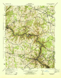
1944 Map of Ellicott City
USGS Topo · Published 1944About this map
The Patapsco River carves a deep, winding valley through the center of this 1940s landscape, serving as the historical boundary between Baltimore County and Howard County. Along its banks, the industrial and educational character of the region is evident, from the heavy concentration of rail infrastructure at Ellicott City to the prominent campuses of Woodstock College and St Marys College. The Baltimore and Ohio railroad tracks follow the river's tight bends, passing through mill towns like Alberton and Oella, which were vital hubs of early Maryland industry.
Find a feature on this map
54 named features on this map. Tap any name to fly to it.
Don’t see what you’re looking for? This feature index may not catch every label — zoom into the map to look around manually.
Map Details
Editions of this 1944 Ellicott City Map
This is the sole edition of this map. No revisions or reprints were ever made.
Other maps of this area

1892 · Laurel
USGS Topo · 1:62,500

1892 · Ellicott
USGS Topo · 1:62,500

1894 · Ellicott
USGS Topo · 1:62,500

1894 · Laurel
USGS Topo · 1:62,500

1894 · Baltimore
USGS Topo · 1:62,500

1894 · Relay
USGS Topo · 1:62,500

1897 · Laurel
USGS Topo · 1:62,500

1899 · Baltimore
USGS Topo · 1:62,500

1904 · Baltimore
USGS Topo · 1:62,500

1906 · Ellicott
USGS Topo · 1:62,500