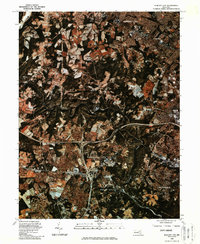
1982 Map of Ellicott City
USGS Topo · Published 1986About this map
The Patapsco River winds through a landscape of shifting land use in this early 1980s orthophotoquad, showing the deep-cut river valley as it separates the growing communities of Ellicott City and Catonsville. This map captures the region during a period of significant suburban expansion, where the traditional agricultural patterns in the northern reaches near Randallstown and Rockdale are increasingly interspersed with residential developments.
Find a feature on this map
7 named features on this map. Tap any name to fly to it.
Don’t see what you’re looking for? This feature index may not catch every label — zoom into the map to look around manually.
Map Details
Editions of this 1982 Ellicott City Map
This is the sole edition of this map. No revisions or reprints were ever made.
Other maps of this area

1892 · Laurel
USGS Topo · 1:62,500

1892 · Ellicott
USGS Topo · 1:62,500

1894 · Ellicott
USGS Topo · 1:62,500

1894 · Laurel
USGS Topo · 1:62,500

1894 · Baltimore
USGS Topo · 1:62,500

1894 · Relay
USGS Topo · 1:62,500

1897 · Laurel
USGS Topo · 1:62,500

1899 · Baltimore
USGS Topo · 1:62,500

1904 · Baltimore
USGS Topo · 1:62,500

1906 · Ellicott
USGS Topo · 1:62,500