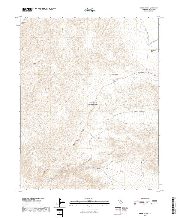
2021 Map of Emigrant Pass
USGS Topo · Published 2021About this map
Death Valley National Park encompasses this portion of the Panamint Range, where the high desert landscape is defined by complex geological formations and historical passage routes. The map documents a high-elevation environment where Emigrant Pass serves as a critical point of navigation between the peaks. The network of canyons, including the winding Nova Canyon and Nemo Canyon, highlights the erosional patterns of the eastern Mojave. In the south, Wildrose Canyon and the presence of Mud Spring indicate the rare water sources that supported early travelers and workers in this arid region. The inclusion of Charcoal Kilns Road and Aguereberry Point Road provides a view into the infrastructure developed to access the area's mineral and timber resources, connecting the high flats like White Sage Flat to the larger desert basin.
Find a feature on this map
21 named features on this map. Tap any name to fly to it.
Don’t see what you’re looking for? This feature index may not catch every label — zoom into the map to look around manually.
Map Details
Editions of this 2021 Emigrant Pass Map
This is the sole edition of this map. No revisions or reprints were ever made.
Other maps of this area

1908 · Ballarat
USGS Topo · 1:250,000

1913 · Ballarat
USGS Topo · 1:250,000

1948 · Death Valley
USGS Topo · 1:250,000

1951 · Panamint Butte
USGS Topo · 1:62,500

1951 · Maturango Peak
USGS Topo · 1:62,500

1952 · Telescope Peak
USGS Topo · 1:62,500

1952 · Emigrant Canyon
USGS Topo · 1:62,500

1954 · Death Valley
USGS Topo · 1:250,000

1956 · Death Valley
USGS Topo · 1:250,000

1957 · Death Valley
USGS Topo · 1:250,000