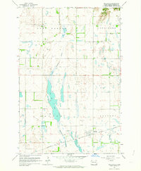
1962 Map of Englevale
USGS Topo · Published 1964About this map
Englevale sits at the intersection of the Northern Pacific railroad and the vast Englevale Slough in the prairie landscape of Ransom County. This 1962 survey, derived from earlier aerial photography and planetable fieldwork, illustrates a drainage system defined by the prominent Lone Tree Lake and numerous depressions across Fort Ransom and Springer townships. The local economy and infrastructure of the early 1960s are evident in the scatter of Gravel Pits and the presence of a Flowing Well south of the main settlement. For genealogists, the map preserves the location of the Stiklestad Cem in the northwestern corner and a Townhall situated in the eastern portion of the quadrangle. The terrain is characterized by subtle elevation changes and section lines that organize the rural homesteads and agricultural plots of Hanson and Elliott townships.
Find a feature on this map
17 named features on this map. Tap any name to fly to it.
Don’t see what you’re looking for? This feature index may not catch every label — zoom into the map to look around manually.
Map Details
Editions of this 1962 Englevale Map
This is the sole edition of this map. No revisions or reprints were ever made.
Other maps of this area

1895 · Lamoure
USGS Topo · 1:125,000

1897 · Tower
USGS Topo · 1:125,000

1897 · Eckelson
USGS Topo · 1:125,000

1918 · La Moure
USGS Topo · 1:125,000

1953 · Jamestown
USGS Topo · 1:250,000

1953 · Fargo
USGS Topo · 1:250,000

1956 · Fargo
USGS Topo · 1:250,000

1956 · Jamestown
USGS Topo · 1:250,000

1957 · Elliott SW
USGS Topo · 1:24,000

1957 · Elliott SE
USGS Topo · 1:24,000