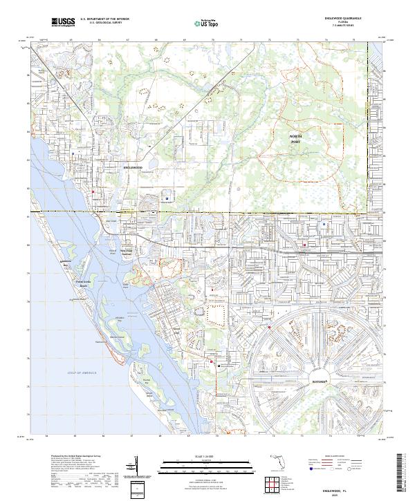
2025 Map of Englewood
USGS Topo · Published 2025About this map
Englewood and the distinctive circular planned community of Rotonda anchor this coastal portrait of Florida’s Gulf shore. The landscape is defined by an intricate network of man-made and natural waterways, including the Intracoastal Waterway, the Butterford Waterway, and the Sea Mist Waterway, which lace through residential developments. Along the barrier islands, Manasota Key and Knight Island separate Lemon Bay from the Gulf, connected by the narrow Stum Pass. The map details the transition from the densely platted streets of North Port to the conservation lands of the Myakka State Forest Trl. Inland, features such as Buchan Airport and the Saint Francis of Assisi Memorial Garden serve as local landmarks. This survey captures a highly engineered coastal environment where residential growth is integrated into a complex system of canals and drainage ways designed for a waterfront lifestyle.
Find a feature on this map
39 named features on this map. Tap any name to fly to it.
Don’t see what you’re looking for? This feature index may not catch every label — zoom into the map to look around manually.
Map Details
Editions of this 2025 Englewood Map
This is the sole edition of this map. No revisions or reprints were ever made.
Other maps of this area

1944 · Myakka River
USGS Topo · 1:31,680

1944 · Venice
USGS Topo · 1:31,680

1956 · Murdock
USGS Topo · 1:24,000

1956 · Englewood
USGS Topo · 1:24,000

1956 · Tampa
USGS Topo · 1:250,000

1956 · Charlotte Harbor
USGS Topo · 1:250,000

1957 · Englewood NW
USGS Topo · 1:24,000

1957 · El Jobean
USGS Topo · 1:24,000

1957 · Punta Gorda SW
USGS Topo · 1:24,000

1957 · Placida
USGS Topo · 1:24,000