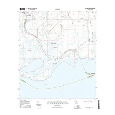
2015 Map of English Lookout
USGS Topo · Published 2015About this map
Pearlington serves as the inland gateway to a complex coastal labyrinth where the Pearl River meets the Gulf of Mexico. This low-lying delta region is defined by a dense network of waterways, including the Old Pearl River, Mulatto Bayou, and Cowan Bayou, which weave around landmasses like Pearl River Island and Desert Island. The landscape reflects the historical and modern importance of water transport, with the Intracoastal Waterway cutting through the southern marshes toward Lake Borgne.
Find a feature on this map
87 named features on this map. Tap any name to fly to it.
Don’t see what you’re looking for? This feature index may not catch every label — zoom into the map to look around manually.
Map Details
Editions of this 2015 English Lookout Map
This is the sole edition of this map. No revisions or reprints were ever made.
Other maps of this area

1893 · Rigolets
USGS Topo · 1:62,500

1893 · Toulme
USGS Topo · 1:62,500

1914 · Nicholson
USGS Topo · 1:62,500

1921 · Nicholson
USGS Topo · 1:62,500

1935 · English Lookout
USGS Topo · 1:31,680

1935 · Grand Island Pass
USGS Topo · 1:31,680

1936 · Rigolets
USGS Topo · 1:62,500

1946 · Malheureux Point
USGS Topo · 1:31,680
1946 · Rigolets
USGS Topo · 1:31,680

1949 · Grand Island Pass
USGS Topo · 1:31,680