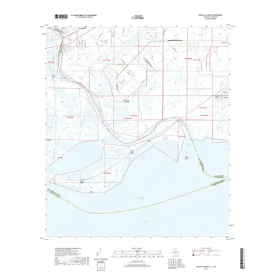
2018 Map of English Lookout
USGS Topo · Published 2018About this map
Pearlington and the surrounding marshlands of Hancock Co sit at the complex meeting point of the Pearl River delta and the Gulf of Mexico. The landscape is a detailed network of tidal channels including Mulatto Bayou, Cowan Bayou, and John Kane Bayou, which navigate around landforms such as Browns Island and Hog Island. This 2018 survey reveals the infrastructure of the Intracoastal Waterway as it cuts through Lake Borgne, reflecting the area's continued importance for coastal navigation. On the eastern edge, the settlement of Ansley sits near Magnolia Ridge, while the historic site of English Lookout remains a point of interest on the river's edge. The map also documents several smaller landings and islands like Jackson Landing and Pearl River Island, which characterize the transitional terrain between the mainland and the open waters of the sound.
Find a feature on this map
80 named features on this map. Tap any name to fly to it.
Don’t see what you’re looking for? This feature index may not catch every label — zoom into the map to look around manually.
Map Details
Editions of this 2018 English Lookout Map
This is the sole edition of this map. No revisions or reprints were ever made.
Other maps of this area

1893 · Rigolets
USGS Topo · 1:62,500

1893 · Toulme
USGS Topo · 1:62,500

1914 · Nicholson
USGS Topo · 1:62,500

1921 · Nicholson
USGS Topo · 1:62,500

1935 · English Lookout
USGS Topo · 1:31,680

1935 · Grand Island Pass
USGS Topo · 1:31,680

1936 · Rigolets
USGS Topo · 1:62,500

1946 · Malheureux Point
USGS Topo · 1:31,680
1946 · Rigolets
USGS Topo · 1:31,680

1949 · Grand Island Pass
USGS Topo · 1:31,680