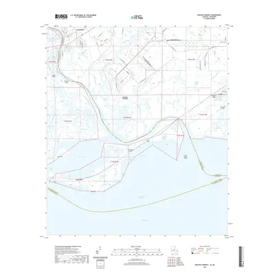
2020 Map of English Lookout
USGS Topo · Published 2020About this map
Pearlington anchors the upper reach of this coastal delta where the Pearl River branches into a complex network of bayous and passes on its way to Lake Borgne. The landscape is a labyrinth of low-lying islands and waterways, including Browns Island, Hog Island, and the marshy expanse of Pearl River Island. Industrial development is concentrated near Jackson Landing and along S Port Bienville Rd, contrasting with the more rural settlement at Ansley to the east. The transition from freshwater river systems to the tidal influence of the Intracoastal Waterway is marked by features like English Lookout and Polecat Bend. This map captures the intricate coastal geography along the Louisiana and Mississippi state line, revealing how the local economy follows the natural paths of Mulatto Bayou and Grand Plains Bayou toward the Gulf.
Find a feature on this map
79 named features on this map. Tap any name to fly to it.
Don’t see what you’re looking for? This feature index may not catch every label — zoom into the map to look around manually.
Map Details
Editions of this 2020 English Lookout Map
This is the sole edition of this map. No revisions or reprints were ever made.
Other maps of this area

1893 · Rigolets
USGS Topo · 1:62,500

1893 · Toulme
USGS Topo · 1:62,500

1914 · Nicholson
USGS Topo · 1:62,500

1921 · Nicholson
USGS Topo · 1:62,500

1935 · English Lookout
USGS Topo · 1:31,680

1935 · Grand Island Pass
USGS Topo · 1:31,680

1936 · Rigolets
USGS Topo · 1:62,500

1946 · Malheureux Point
USGS Topo · 1:31,680
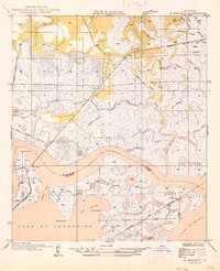
1946 · Rigolets
USGS Topo · 1:31,680

1949 · Grand Island Pass
USGS Topo · 1:31,680