
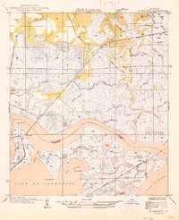
1935 Map of English Lookout
USGS Topo · Published 1935About this map
The Pearl River delta and the marshlands of the Louisiana-Mississippi border are documented here during a period of transition in the mid-1930s. The settlement of English Lookout serves as a primary waypoint along the Louisville and Nashville railroad, which cuts a straight path across the wetlands and open water. The map reveals an intricate network of coastal waterways including Little Lake Pass, North Pass, and East Mouth, illustrating how the delta is fragmented by tidal movement and river outflow into Lake Borgne.
Find a feature on this map
26 named features on this map. Tap any name to fly to it.
Don’t see what you’re looking for? This feature index may not catch every label — zoom into the map to look around manually.
Map Details
Editions of this 1935 English Lookout Map
This is the sole edition of this map. No revisions or reprints were ever made.
Other maps of this area

1893 · Rigolets
USGS Topo · 1:62,500

1893 · Toulme
USGS Topo · 1:62,500

1914 · Nicholson
USGS Topo · 1:62,500

1921 · Nicholson
USGS Topo · 1:62,500

1935 · Grand Island Pass
USGS Topo · 1:31,680

1936 · Rigolets
USGS Topo · 1:62,500

1946 · Malheureux Point
USGS Topo · 1:31,680
1946 · Rigolets
USGS Topo · 1:31,680

1949 · Grand Island Pass
USGS Topo · 1:31,680
1949 · False Mouth Bayou
USGS Topo · 1:31,680