
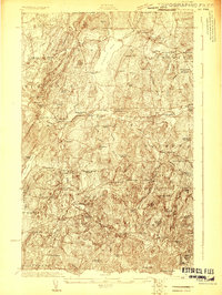
1922 Map of Enosburg Falls
USGS Topo · Published 1922About this map
Missisquoi River drainage patterns and the United States Canada international boundary define this 1922 topographic study of northern Vermont. The landscape is heavily marked by a dense network of district schools, including Lost Nation School, Pumpkin Village School, and St Rocks School, reflecting a period when small, localized education centers served every valley and ridge. The rail economy is in full swing, with the St Johnsbury and Lake Champlain RR and the Central Vermont line connecting industrial hubs like Enosburg Falls and Sheldon Junction. Local industry is evidenced by the Gilbert Tannery and Woodard Mill, while settlements like Morses Line sit directly on the northern boundary line. This map offers a detailed view of Franklin County's agrarian and industrial layout before mid-century modernization consolidated these many rural institutions.
Find a feature on this map
103 named features on this map. Tap any name to fly to it.
Don’t see what you’re looking for? This feature index may not catch every label — zoom into the map to look around manually.
Map Details
Editions of this 1922 Enosburg Falls Map
2 editions found
Other maps of this area

1913 · Milton
USGS Topo · 1:48,000

1914 · St. Albans
USGS Topo · 1:48,000

1915 · Milton
USGS Topo · 1:62,500

1916 · St. Albans
USGS Topo · 1:62,500

1919 · Montgomery
USGS Topo · 1:62,500

1920 · Franklin Pond
USGS Topo · 1:62,500

1920 · Montgomery
USGS Topo · 1:62,500

1924 · Enosburg Falls
USGS Topo · 1:62,500

1925 · Jay Peak
USGS Topo · 1:62,500

1925 · Mount Mansfield
USGS Topo · 1:48,000