
1896 Map of Equinox
USGS Topo · Published 1896About this map
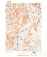
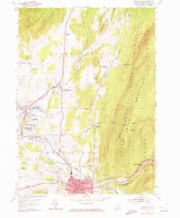
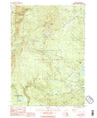
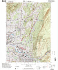
The Batten Kill River valley serves as the primary corridor for settlement and industry in this late 19th-century survey of Bennington County. The Bennington and Rutland R. R. follows the river's path, connecting hubs like Manchester Center and Arlington. While the valley floor is densely populated with small industrial centers such as Chiselville and East Arlington, the surrounding highlands of the Green Mountain range are defined by numerous hollows and peaks. Insight into the era's mountain economy is visible at Kelley Stand and the remote Fayville settlement to the south. Notable geological and recreational landmarks including Equinox Mountain and Equinox Pond dominate the central landscape, while the D. & H. R. R. cuts through the northwest corner near West Rupert, highlighting the importance of rail transit for these Vermont communities.
Find a feature on this map
95 named features on this map. Tap any name to fly to it.
Don’t see what you’re looking for? This feature index may not catch every label — zoom into the map to look around manually.
Map Details
Editions of this 1896 Equinox Map
This is the sole edition of this map. No revisions or reprints were ever made.
Historical Maps of Manchester Through Time
29 maps found
1894 Equinox
Bennington County, VT
1896 Equinox
Bennington County, VT
1898 Bennington
Bennington County, VT
1900 Equinox
Bennington County, VT
1954 Bennington
Bennington County, VT
1954 Bennington
Bennington County, VT
1954 Woodford
Bennington County, VT
1967 Arlington
Bennington County, VT
1967 West Rupert
Bennington County, VT

1968 Manchester
Bennington County, VT

1968 Sunderland
Bennington County, VT
1986 Peru
Bennington County, VT
1987 Readsboro
Bennington County, VT
1995 West Rupert
Bennington County, VT
1997 Arlington
Bennington County, VT
1997 Bennington
Bennington County, VT

1997 Manchester
Bennington County, VT
1997 Peru
Bennington County, VT
1997 Readsboro
Bennington County, VT

1997 Sunderland
Bennington County, VT
1997 Woodford
Bennington County, VT
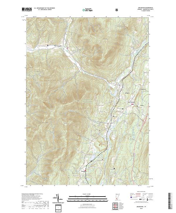
2024 Arlington
Bennington County, VT
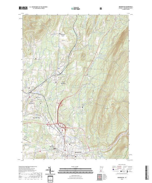
2024 Bennington
Bennington County, VT
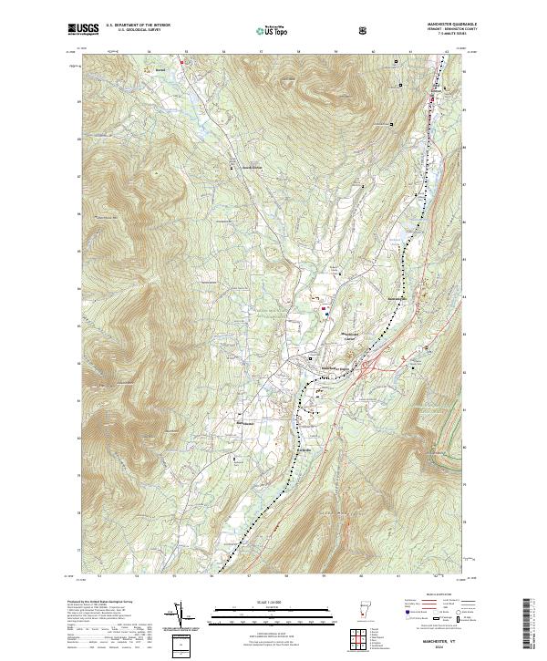
2024 Manchester
Bennington County, VT
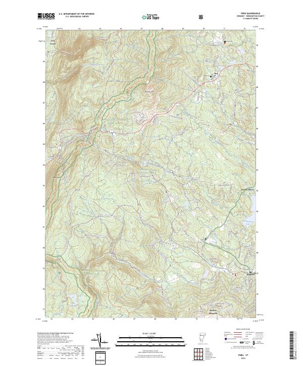
2024 Peru
Bennington County, VT
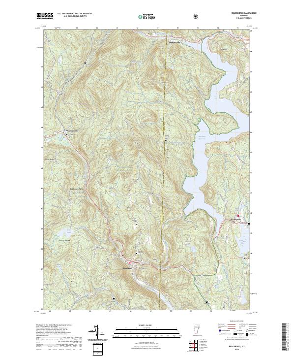
2024 Readsboro
Bennington County, VT
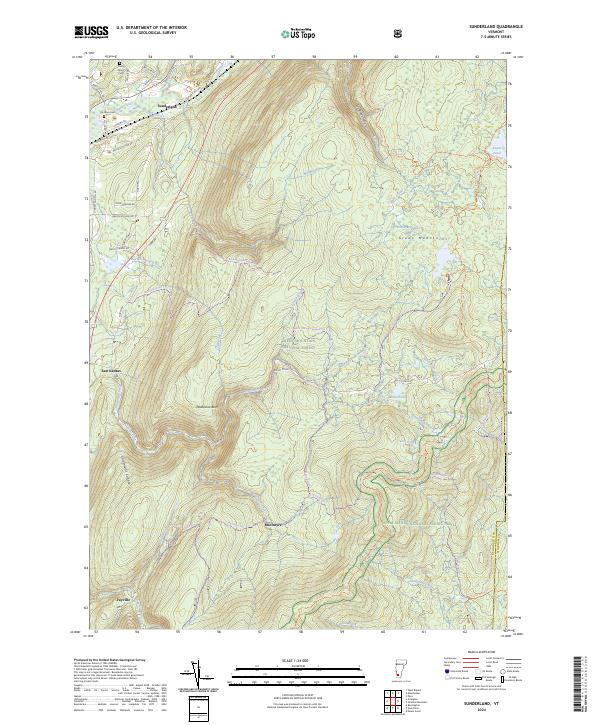
2024 Sunderland
Bennington County, VT
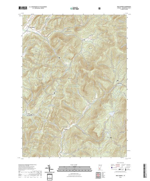
2024 West Rupert
Bennington County, VT
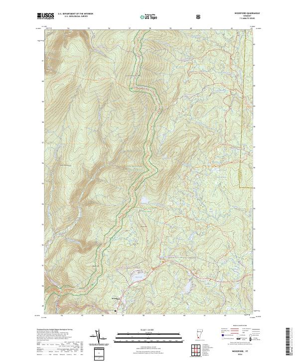
2024 Woodford
Bennington County, VT