
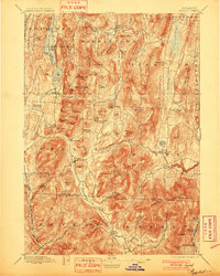
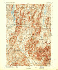
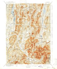
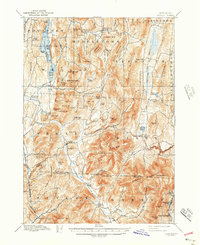
1897 Map of Pawlet
USGS Topo · Published 1897About this map
Middletown Springs and the village of Pawlet anchor this late 19th-century topographic study of the Taconic Mountains region. The landscape is a complex arrangement of high peaks and narrow valleys, where the Mettawee River and Flower Brook provide the primary drainage. Transport at this time relied on the Delaware and Hudson RR skirting the western edge and the Bennington and Rutland RR to the east, connecting the isolated hamlets of North Rupert and East Rupert. The map reveals the density of small rural communities like Brimstone Corners, Spanktown, and Freedleyville, many of which were tied to the local agriculture and quarrying industries common to the Vermont-New York borderlands. Significant water bodies like St. Catharine Lake and Tinmouth Pond are mapped in detail, showing their relationship to the surrounding summits of Spoon Mountain and Tinmouth Mountain.
Find a feature on this map
97 named features on this map. Tap any name to fly to it.
Don’t see what you’re looking for? This feature index may not catch every label — zoom into the map to look around manually.
Map Details
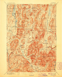
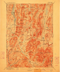
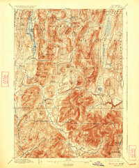
Editions of this 1897 Pawlet Map
8 editions found
Other maps of this area

1891 · Rutland
USGS Topo · 1:62,500

1893 · Wallingford
USGS Topo · 1:62,500

1893 · Rutland
USGS Topo · 1:62,500

1893 · Fort Ann
USGS Topo · 1:62,500

1893 · Whitehall
USGS Topo · 1:62,500

1894 · Londonderry
USGS Topo · 1:62,500

1894 · Pawlet
USGS Topo · 1:62,500

1894 · Equinox
USGS Topo · 1:62,500

1895 · Whitehall
USGS Topo · 1:62,500

1895 · Cambridge
USGS Topo · 1:62,500