2022 Map of Erhard
USGS Topo · Published 2022About this map
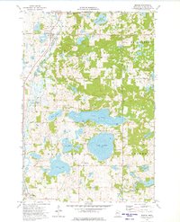
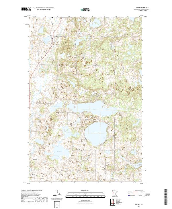
The Pelican River snakes through the western portion of this Otter Tail County landscape, connecting the small settlements of Erhard in the north and Elizabeth in the south. This region is defined by its glacial topography, featuring a dense network of water bodies including the large Lake Jewett, Lake Mason, and the aptly named Devils Lake. These lakes are joined by a web of local roads such as Co Hwy 27 and Reed Creek Rd, which provide access to the various shorelines and rural properties. To the east, the terrain remains densely pitted with smaller basins like Wolf Lake and McCoy Lake near the Otter Tail River drainage. The map reveals the intricate drainage patterns of Reed Cr and the concentration of development around Erhard's Main St, offering a clear view of how modern infrastructure navigates this water-dominant environment.
Find a feature on this map
65 named features on this map. Tap any name to fly to it.
Don’t see what you’re looking for? This feature index may not catch every label — zoom into the map to look around manually.
Map Details
Editions of this 2022 Erhard Map
This is the sole edition of this map. No revisions or reprints were ever made.