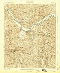
1931 Map of Erin
USGS Topo · Published 1931About this map
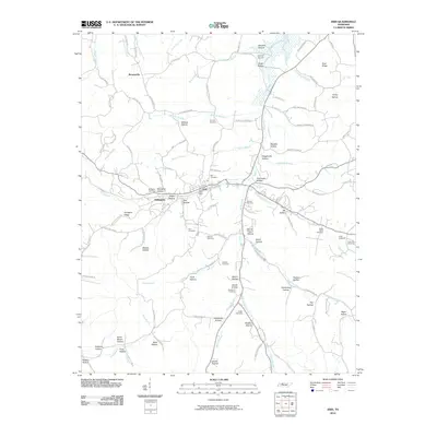
Erin serves as a central hub in this 1927 survey, situated at the junction of the Louisville and Nashville railroad and State Highway No 13. The landscape is defined by the winding Cumberland River, where river navigation is supported by Lock and Dam No 2 and a series of historical landings like Taylors Landing and York Landing. The surrounding hills are densely dotted with rural social structures, including the Blooming Grove Ch, Cave Orchard Sch, and McKendry Ch, revealing a pattern of distributed small-acreage settlements and farming communities.
Find a feature on this map
95 named features on this map. Tap any name to fly to it.
Don’t see what you’re looking for? This feature index may not catch every label — zoom into the map to look around manually.
Map Details
Editions of this 1931 Erin Map
This is the sole edition of this map. No revisions or reprints were ever made.
Historical Maps of Erin Through Time
7 maps found