
1936 Map of Woolworth
USGS Topo · Published 1936About this map
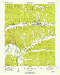
Woolworth serves as a focal point for this rural landscape along the Houston Humphreys Co Co border, where social life centered around numerous neighborhood institutions. The settlement pattern is defined by narrow hollows like Warden Hollow and Mule Lot Hollow that feed into Whiteoak Creek. The map documents a significant network of country schools, including Woolworth Sch, Richardson Sch, and the high-elevation Silvertop Sch, reflecting the community's decentralized structure before school consolidation. Spiritual life is similarly distributed among congregations at New Hope Ch, Highview Ch, and Curtis Chapel.
Find a feature on this map
64 named features on this map. Tap any name to fly to it.
Don’t see what you’re looking for? This feature index may not catch every label — zoom into the map to look around manually.
Map Details
Editions of this 1936 Woolworth Map
This is the sole edition of this map. No revisions or reprints were ever made.
Other maps of this area

1931 · Erin
USGS Topo · 1:62,500

1936 · Gorman
USGS Topo · 1:24,000

1936 · Tantrough Hollow
USGS Topo · 1:24,000

1936 · Ruskin
USGS Topo · 1:24,000

1936 · Stewart
USGS Topo · 1:24,000

1936 · Halls Creek
USGS Topo · 1:24,000

1936 · Waverly
USGS Topo · 1:24,000

1936 · Tennessee City
USGS Topo · 1:24,000

1950 · Halls Creek
USGS Topo · 1:24,000
1950 · Waverly
USGS Topo · 1:24,000