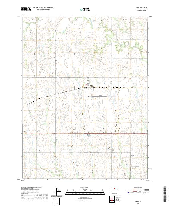
2022 Map of Esbon
USGS Topo · Published 2022About this map
Esbon serves as the primary hub of this north-central Kansas landscape, situated where Grand Ave and Kansas Ave meet the local rail corridor. The area's settlement pattern is defined by a dense network of sectional roads like Otego Rd and V Rd, which navigate the various drainage systems feeding into White Rock Creek and W Limestone Creek. This survey captures the rural continuity of Jewell County, highlighting the geographic distribution of early community centers like Salem in the northwest. Genealogy and local history are anchored by several established burial grounds, including Prairie Home Cemetery and Saint Elizabeth Cemetery, which are scattered among the agricultural plots. The map traces the natural meandering paths of Porcupine Creek and Smith Creek, showing how the topography influenced the placement of homesteads and connecting roads during the late twentieth and early twenty-first centuries.
Find a feature on this map
29 named features on this map. Tap any name to fly to it.
Don’t see what you’re looking for? This feature index may not catch every label — zoom into the map to look around manually.
Map Details
Editions of this 2022 Esbon Map
This is the sole edition of this map. No revisions or reprints were ever made.
Other maps of this area

1893 · Smith Center
USGS Topo · 1:125,000

1894 · Mankato
USGS Topo · 1:125,000

1955 · Beloit
USGS Topo · 1:250,000

1959 · Beloit
USGS Topo · 1:250,000
1968 · Burr Oak NW
USGS Topo · 1:24,000

1968 · Burr Oak
USGS Topo · 1:24,000
1969 · Ionia
USGS Topo · 1:24,000
1969 · Cawker City NW
USGS Topo · 1:24,000
1969 · North Branch
USGS Topo · 1:24,000
1969 · Esbon
USGS Topo · 1:24,000