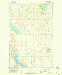
1958 Map of Esmond
USGS Topo · Published 1960About this map
The town of Esmond serves as the focal point of this late 1950s survey, marking the terminus of the Northern Pacific railroad line. This agricultural and wetland landscape is defined by the prairie pothole topography of the Missouri River Basin, where numerous water bodies like Long Lake and Cranberry Lake dot the township divisions of Elverum, Impark, and Esmond. To the southwest, the Buffalo Lake National Wildlife Refuge encompasses the waters of Buffalo Lake, fed by the Buffalo Coulee. The presence of the Esmond Cem and several local Gravel Pits reflects the community's domestic and industrial footprint during this era. The Sheyenne River cuts across the southern portion of the quadrangle, joined by Trappers Coulee as it moves through the plains of Alexander and Rich Valley.
Find a feature on this map
20 named features on this map. Tap any name to fly to it.
Don’t see what you’re looking for? This feature index may not catch every label — zoom into the map to look around manually.
Map Details
Editions of this 1958 Esmond Map
This is the sole edition of this map. No revisions or reprints were ever made.
Other maps of this area

1941 · Selz
USGS Topo · 1:62,500

1943 · Maddock
USGS Topo · 1:62,500

1945 · Maddock
USGS Topo · 1:62,500

1951 · Selz NE
USGS Topo · 1:24,000

1951 · Selz NW
USGS Topo · 1:24,000

1951 · Hesper
USGS Topo · 1:24,000

1952 · New Rockford
USGS Topo · 1:250,000

1953 · Devils Lake
USGS Topo · 1:250,000

1956 · New Rockford
USGS Topo · 1:250,000

1956 · Devils Lake
USGS Topo · 1:250,000