2024 Map of Evans
USGS Topo · Published 2024About this map
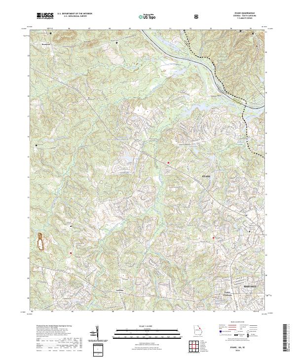
Savannah River defines the northeastern boundary of this Georgia landscape, separating Columbia County from South Carolina and the Sumter National Forest. The transition from the rural northern terrain of Burks Mtn to the suburban expansion of Evans and Martinez is clearly visible. Genealogists will find a high concentration of burial sites, including the First Baptist Church of Evans Cem, Old Avery Cem, and Hopewell Cem. The southern reach of the map features a distinctive series of water features on Mill Branch, such as Niagra Falls, Great Falls, and Silver Run Falls, highlighting the area's complex hydrology. While Evans serves as a modern civic center with the Evans Justice Center, older community nodes like Rosemont, Lewiston, and Ropers Crossroads illustrate the historical settlement patterns of the region.
Find a feature on this map
260 named features on this map. Tap any name to fly to it.
Don’t see what you’re looking for? This feature index may not catch every label — zoom into the map to look around manually.
Map Details
Editions of this 2024 Evans Map
This is the sole edition of this map. No revisions or reprints were ever made.
Historical Maps of Deerwood Acres Through Time
Featured Locations
- Deerwood Acres, GA
- Deerwood Estates, GA
- Evanston, Evans
- Shady Grove Estates, Evans
- Calloway Woods, Evans