2024 Map of Excel
USGS Topo · Published 2024About this map
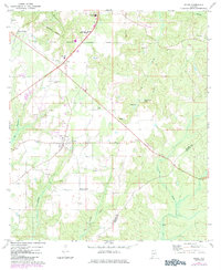
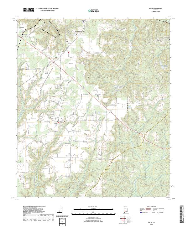
Monroeville serves as the northern anchor for this study of Monroe County, showing a landscape defined by small crossroads settlements and agricultural developments. The southern portion of the quadrangle is dominated by the town of Excel, where the Excel Frisco Hwy and several local routes converge near the Excel Cem. Further south, the rural character is punctuated by Halls Crossroads, where wood-fringed creeks like Corley Creek and Big Escambia Creek drain the low-lying terrain. The map captures a moment of modern institutional presence, featuring the Alabama Southern Community College and the Monroe County Aeroplex alongside traditional family landmarks such as McMillan Cem and Daily Cem. This balance of historic rural centers like Mexia Crossing and Drewry with contemporary aviation and educational infrastructure illustrates the evolving economic footprint of the region.
Find a feature on this map
94 named features on this map. Tap any name to fly to it.
Don’t see what you’re looking for? This feature index may not catch every label — zoom into the map to look around manually.
Map Details
Editions of this 2024 Excel Map
This is the sole edition of this map. No revisions or reprints were ever made.