2024 Map of Fair Play
USGS Topo · Published 2024About this map
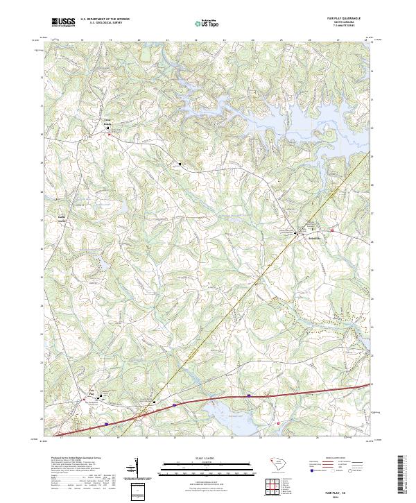
The boundary between Oconee and Anderson counties bisects this landscape of winding creek systems and modern reservoirs. To the south, the waters of Hartwell Lake create a deeply indented shoreline near the community of Fair Play, where the Play Presbyterian Church Cem and Beaverdam Baptist Church Cem preserve the region's local heritage. Further north, the settlement of Townville serves as a local hub, surrounded by institutional landmarks like the Townville Baptist Church Graveyard and Dickson Memorial United Methodist Church.
Find a feature on this map
158 named features on this map. Tap any name to fly to it.
Don’t see what you’re looking for? This feature index may not catch every label — zoom into the map to look around manually.
Map Details
Editions of this 2024 Fair Play Map
This is the sole edition of this map. No revisions or reprints were ever made.