2023 Map of Fairview
USGS Topo · Published 2023About this map
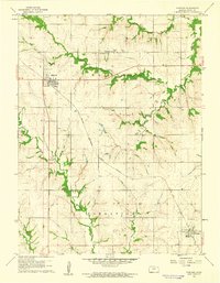
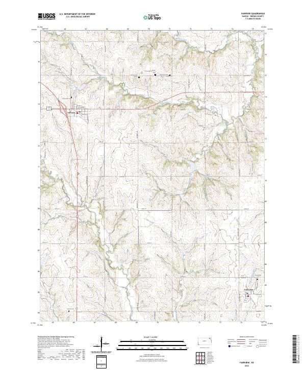
Fairview and Powhattan serve as the primary hubs of this Brown County landscape, where the agricultural grid is deeply etched by the branching headwaters of the Wolf River and Delaware River. The map reveals a high concentration of small, family, and congregational burial grounds, such as Lambertson Cem and Old Fairview Cem, which speak to the area's early settlement patterns. This network of rural cemeteries, including Immanuel Lutheran Cem and Saint Paul Cem, often marks the former locations of early community centers and farmsteads. The terrain is defined by the convergence of numerous named waterways like Mulberry Creek, Oaks Creek, and Grasshopper Cr, which cut through the survey's township and range divisions. Local researchers can trace the modern road system, including named routes like Cora Berry Rd and Falcon Rd, against the natural drainage of the Little Delaware River, illustrating how the region's geography dictated the placement of homesteads and connecting routes.
Find a feature on this map
46 named features on this map. Tap any name to fly to it.
Don’t see what you’re looking for? This feature index may not catch every label — zoom into the map to look around manually.
Map Details
Editions of this 2023 Fairview Map
This is the sole edition of this map. No revisions or reprints were ever made.