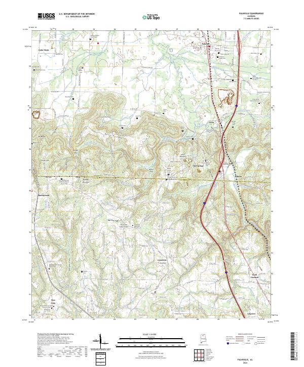
2024 Map of Falkville
USGS Topo · Published 2024About this map
Falkville serves as the primary hub for this corridor along the Csx Transportation line, where the northern foothills of the Appalachian plateau meet the agricultural plains. The landscape is defined by the Tennessee Valley Divide, which separates the drainages of Flint Creek and its many tributaries, including Sally Mike Creek and Robinson Creek. The terrain transitions from the elevated heights of Brindley Mountain and Lacon Mountain to the flat expanse of Cedar Plains. Local genealogy is well-preserved through numerous family and church burial sites such as the Patterson Family Cem, Speegle-King Cem, and the Turney Family and Community Cem. Small communities like Lacon, Battleground, and South Vinemont are connected by a network of county roads that navigate the complex topography of gaps and hollows, including Day Gap and Coon Hollow.
Find a feature on this map
182 named features on this map. Tap any name to fly to it.
Don’t see what you’re looking for? This feature index may not catch every label — zoom into the map to look around manually.
Map Details
Editions of this 2024 Falkville Map
This is the sole edition of this map. No revisions or reprints were ever made.
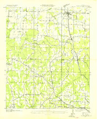
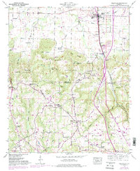
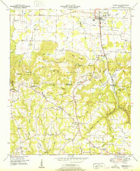
Historical Maps of Thomas Place Through Time
4 maps found