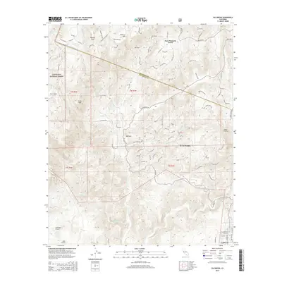
2015 Map of Fallbrook
USGS Topo · Published 2015About this map
Santa Margarita Groves and the community of De Luz define this inland corridor where the Riverside and San Diego county line crosses varied terrain. The landscape is characterized by a series of prominent mesas, including Redonda Mesa and Aveñaloca Mesa, separated by deep drainage systems like Sandia Canyon and Las Pulgas Canyon. In the southern portion of the sheet, the northern edge of Fallbrook is visible, showing the residential street grid near S Mission Rd. The presence of Ross Lake and the winding course of De Luz Cr highlight the vital role of water in this semi-arid environment, supporting the agricultural groves and local settlements. To the west, the boundary of the Cleveland National Forest marks a transition to protected lands near Devil Canyon.
Find a feature on this map
91 named features on this map. Tap any name to fly to it.
Don’t see what you’re looking for? This feature index may not catch every label — zoom into the map to look around manually.
Map Details
Editions of this 2015 Fallbrook Map
This is the sole edition of this map. No revisions or reprints were ever made.
Other maps of this area

1901 · Southern California Sheet No. 1
USGS Topo · 1:250,000

1901 · Elsinore
USGS Topo · 1:125,000

1901 · San Luis Rey
USGS Topo · 1:125,000

1904 · Southern California Sheet No. 2
USGS Topo · 1:250,000

1904 · Southern California Sheet No. 1
USGS Topo · 1:250,000

1941 · Margarita Peak
USGS Topo · 1:62,500

1942 · Lake Elsinore
USGS Topo · 1:62,500

1942 · Margarita Peak
USGS Topo · 1:62,500

1942 · Temecula
USGS Topo · 1:62,500

1942 · Murrieta
USGS Topo · 1:62,500
Featured Places
- Fallbrook, CA
- De Luz Heights, CA
- Marine Corps Base Camp Pendleton, CA
- De Luz, CA
- Santa Margarita Groves, CA